Настоящите правила разкриват политиката ни за защита на личните данни, събирани от потребителите на уебсайта www.ximaps.com, наричан за краткост навсякъде тук „Уебсайт”.
Доставчикът на услуги и съдържание на уебсайта е регистриран Администратор на лични данни в съответните регистри, поддържани от Комисията за защита на личните данни, за което му е издадено Удостоверение №399792 в КЗЛД /26.03.2014г.
Събирането, обработването и съхранението на личните данни на потребителите на уебсайта се извършва в съответствие с изискванията на Закона за защита на личните данни и приложимото действащо българско и европейско законодателство.
„Лични данни” са всички данни, които съдържат идентифицираща информация (адрес, телефон, e-mail и други) за физическите лица.
Използването на услугите на уебсайта изисква приемане и съгласие с настоящите правила за защита на личните данни. С приемането на настоящите правила, Потребителят дава своето изрично съгласие да е обвързан с разпоредбите на настоящия документ, както и да получава на посочения при регистрацията в уебсайта електронен адрес съобщения от Доставчика КСИМАПС ЕООД и всякаква друга информация за отстъпки, промоции, нови продукти и услуги и други търговски съобщения, които при никакви обстоятелства няма да се разглеждат от Потребителя като „непоискани търговски съобщения” по смисъла, употребен в чл.6, ал.1 от Закона за електронната търговия.
Цели
Личните данни, които събираме са необходими за успешна потребителска регистрация на потребители физически лица, за да получаваме обратна връзка за качеството на уебсайта, предложения за подобряването и разширяването на съдържанието и ресурсите, да ви информираме за промени и новости и за да ви осигуряваме своевременна техническа и друга помощ, при необходимост.
Предоставените от вас лични данни използваме за:
• Коректно и точно изпълнение на услугите, предоставени в уебсайта.
• Осигуряване на сигурно и надеждно използване на уебсайта чрез верификация на правата ви за достъп до заявените от вас услуги и ресурси;
• Да подобряваме постоянно качеството на нашите услуги и съдържание чрез получаването на попълнени и изпратени от вас анкети, проучвания, предложения, съвети и идеи за разширяване на съществуващите и въвеждане на нови услуги чрез нашия уебсайт.
• Да ви изпращаме новини, електронни бюлетини, промоции, оферти, интересна и полезна информация и други новости.
• Да ви осигурим специализирана информация за пълноценното използване и достъп до услуги и други ресурси на нашия уебсайт, с инструкции, указания и друго полезно съдържание чрез получените данни за вашите предпочитания;
Не събираме лични данни, които:
• разкриват расов или етнически произход;
• разкриват политически, религиозни или философски убеждения;
• разкриват членство в политически партии или организации, сдружения с религиозни, философски, политически или синдикални цели;
• се отнасят до здравето, сексуалния живот или до човешкия геном;
• се предоставят от непълнолетни потребители без съгласието на родителите или законните им представители.
Потребителска регистрация
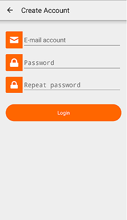
Когато се регистрирате, за да използвате уебсайта, ще ви бъде поискана информация, която е необходима единствено и само за използването на услугите и съдържанието на уебсайта. Поисканата информация може да бъде относно вашето име, възраст, пол, местонахождение /град, селище/, e-mail, IP адрес и други данни, необходими за пълноценното използване на услугите и ресурсите на уебсайта. Част от информацията е задължителна за създаването на потребителски акаунт, а друга част е опционна. Във формата за регистрация това е указано. Ако във вашите данни настъпят промени (например, промяна на мейл адрес или друг контакт), необходимо е да ни информирате за тези промени, за да поддържаме актуална и точна информация за тези данни. Ние полагаме необходимите грижи, за да поддържаме вашите данни актуални, в рамките на свободно и доброволно предоставената от вас информация и като зачитаме вашите предпочитания.
Потребителят е отговорен за предоставената информация за контакт и други данни, които са неверни, фалшиви или се отнасят за трети лица (във всички случаи, когато третите лица не са дали съгласие за това), както и за всякаква незаконна или злоумишлена употреба на лични данни и информация.
Въведените лични данни във вашата потребителска регистрация могат да се актуализират и можете по всяко време и по ваша преценка да преглеждате и да правите промени в данните на вашата регистрация, да променяте предпочитанията и зададените от вас настройки, както и да заличите изцяло вашата потребителска регистрация. Пълното заличаването на регистрация с лични данни се извършва след получаването на вашето изрично желание за това, изпратено до нас на следния e-mail: info@ximaps.com
Достъп до лични данни
Когато посещавате уебсайта вие се идентифицирате като потребител чрез вашата потребителска регистрация или чрез вашия IP адрес, който представлява поредица от четири числа и обозначава интернет адреса, откъдето вие осъществявате достъп до уебсайта. Вашият IP адрес насочва към вашия интернет доставчик и може да бъде проследим от всеки, който въведе този адрес и направи търсене в интернет по него.
Като регистриран потребител на уебсайта, вие имате постоянен достъп до вашите лични данни и винаги, по всяко време, можете да проверявате какви данни се съхраняват за вас, да редактирате, променяте и изтривате тези данни по ваше усмотрение.
Съхраняване и обработване на лични данни
Предоставените лични данни съхраняваме за период от време, който е необходим за да изпълним целите, за които събираме и обработваме тези данни, така както са посочени в настоящите правила и в други случаи, определени със закони.
Персоналната информация, предоставена от вас се използва за целите, посочени в настоящите правила, за анализ на тенденциите в интернет и за подобряване на съдържанието и функционалността на сайта. Тази информация не се предоставя при никакви обстоятелства на трети лица, освен в случаите, когато сме получили вашето изрично съгласие за това и в случаите, предвидени от приложимото законодателство или при доказана злоупотреба с лични данни. Не продаваме, нито отдаваме под наем, нито предоставяме възмездно и не разпространяваме идентифицираща лична информация от вашия потребителския акаунт на други компании, организации и трети страни.
При посещение на уебсайт, вашият браузър изпраща голямо количество и разнообразна информация до уебсървъра. Повечето уебсървъри поддържат логове на достъпа на потребителите. В тези логове се съдържа информация, която може да се използва за съставяне на цялостна картина за популярността на страниците, за входящите към тях връзки от други сайтове и за различните браузъри, използвани от потребителите. Информацията от тези логове използваме за изготвянето на статистики за посещаемостта на уебсайта. Необработените данни не се разкриват публично и се унищожават периодично.
Разкриване на лични данни
Нашата политика за предоставяне на лични данни предвижда разкриването им в следните случаи:
• При получаване на съдебно разпореждане, призовка или друго искане със задължителен характер от органите на правораздаването.
• При писмено искане на засегнат потребител или при получено разрешение от него.
• При необходимост от разследване на жалби за извършени злоупотреби.
• Когато разкриването на данните е необходимо, за да се разрешат належащи проблеми от техническо естество.
• Когато потребителят вандализира съдъжанието на уебсайта, демонстрира постоянно вредоносно поведение или извършва други злоумишлени и незаконни действия, данните за неговата самоличност могат да бъдат разкрити, за да се улесни проследяването на IP-регистрите или да се отправят жалби към съответните доставчици на интернет услуги.
• Когато има обоснована необходимост да се защитят правата, собствеността или сигурността на потребителите на уебсайта или друг защитим обществен интерес.
Използване на cookies
Използването на cookies е общоприета и утвърдена практика в интернет. За идентификация на трафика, който идва към сървърите от рекламни и други сайтове за оценка ефективността на рекламата в тях и за да се осигури по-дружелюбен интерфейс на сайта, използваме cookies. Използването на cookies е общоприета и утвърдена практика в интернет. Във всички случаи ако това обстоятелство ви притеснява можете да забраните на браузъра си да обработва cookies. В някои случаи блокирането на cookies в браузъра може да доведе до проблеми при използването на уебсайта.
За блокиране на бисквитки в конкретен браузър, научете повече тук:
• Google Chrome
• Firefox
• Internet Explorer
• Safari
Защита на личните данни
Предоставените лични данни на потребителите се обработват и съхраняват законосъобразно и добросъвестно, само за целите на предоставянето на услугите и съдържанието на уебсайта. За обработването, съхранението и защитата на личните данни са предприети необходимите технически и организационни мерки, за да бъдат защитени тези данни от случайно или незаконно унищожаване, или от случайна загуба, от неправомерен достъп, изменение или разпространение, както и от други незаконни форми на достъп и разпространение.
Мерките са съобразени със съвременните технологични постижения и осигуряват ниво на защита, което съответства на рисковете, свързани с обработването, и на естеството на данните, които трябва да бъдат защитени.
Изключени са всякакви гаранции срещу неоторизиран достъп до каквато и да е информация или до част от предоставената персонална информация.
Публикуваните тук Правила и политика за защита на личните данни са приложими и валидни само за потребителите на уебсайта www.ximaps.com. Правилата и политиката не се прилагат по отношение на други уебсайтове, социални мрежи, платформи, компании или организации, към които препраща или е свързан уебсайта.
Всички промени в настоящите правила ще бъдат публикувани в този раздел и ще бъдат ефективни от датата, посочена в тях за влизане в сила.
Настоящите правила и политика за защита на личните данни са в сила от 01.01.2016г.


 +359 877 946 277
 ximaps (at) gmail.com